Geneva, Florida  ·  A Local History

The Town That Sits
on a Bubble


Everything around it filled in — Sanford, Oviedo, Lake Mary. Geneva stayed cattle and citrus and acre lots. The reason isn’t that the growth never came. It’s a pocket of fresh water, about the size of the town, floating on salt — and what people decided to do about it.

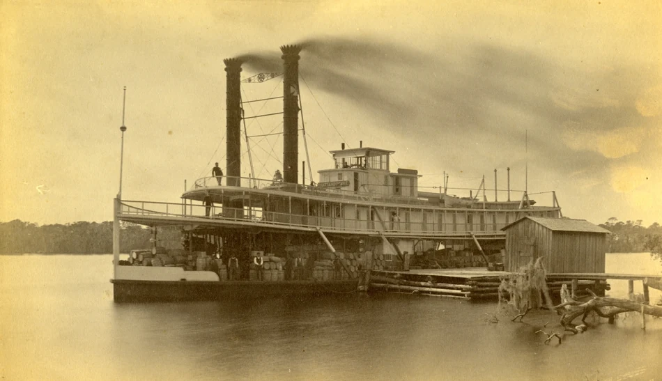
A wooden sternwheel steamboat tied up at a river landing, its tall smokestacks and stacked freight reflected in still water, with low trees along the far bank.
Up the St. Johns to Lake Harney
The only road in. A paddlewheel steamer on the St. Johns River — for most of the 1800s the river was the highway into this country, and Lake Harney was about as far up it as a big boat could go. Steamer “Chattahoochee,” St. Johns River, circa 1880s–1890s; State Archives of Florida, via Wikimedia Commons. A representative river steamer, not Geneva itself.

Pour a glass of water anywhere in Geneva and it came up out of the ground directly under your feet. Drive a few miles out — toward Lake Jesup, down to the Econ, across Lake Harney — sink a well, and you’ll pull up salt. Not quite seawater, but water salty enough you wouldn’t drink it or put it on a garden.

So there’s a patch of sweet water sitting in the ground out here with a ring of salt clear around it. And here’s the strange part: the patch is just about the shape and size of the town. That’s worth stopping on, because it turns out to explain almost everything about why Geneva still looks the way it does — cattle, orange trees, houses set a long way apart — while the rest of this county filled up with subdivisions.

Why is the fresh water only here? To get the answer, you have to start back when the only way into this country was by boat.

When the river was the only road

Geneva sits on the north shoulder of Lake Harney, a wide spot in the St. Johns River out on the east edge of what’s now Seminole County. Long before a paved road reached it, the St. Johns was the highway, and Lake Harney was about as far up it as a good-sized steamboat could reliably go. Boats came up from Jacksonville and Sanford hauling people and freight, and the lake was where the river traffic thinned out and the real backcountry began.

An 1890 survey map detail showing Lake Harney at right and Lake Jesup at center, with the small town of Geneva labeled on the north shore of Lake Harney, and Sanford and Lake Monroe at upper left.
Geneva, on the north shore — 1890
Out at the end of the water. Geneva sits on the north shore of Lake Harney, between the lake and Lake Jesup, with the St. Johns running up past it. Detail from “Map of Orange County, Florida,” J.O. Fries, County Surveyor, 1890 (Geneva was in Orange County until Seminole split off in 1913). Library of Congress, Geography & Map Division.

The Army had figured that out early. In 1837, during the Second Seminole War, soldiers put up a supply post called Fort Lane on the west shore of the lake — a staging point for building forts further upriver. It didn’t last long; by the next spring the troops had moved on. But it marked the spot for the same reason everything else would land here: this was the end of the easy traveling and the start of the open country.

Tall, widely spaced longleaf pines beside a sandy road running back into the woods, with a small horse-drawn buggy far down the road.
The wilds, out past the lake
What lay beyond the landing. Open longleaf-pine country like the land around Geneva — the kind of place you reached by river and then kept to yourself. “In the Pine Woods, Florida,” Detroit Publishing Co., 1904; Library of Congress. A representative regional scene, not Geneva itself.

That open country drew the kind of person who wanted exactly that. One of them was an old soldier named Mansfield, who’d fought in the Seminole War, settled on the east shore of Lake Harney around 1835, and more or less never left. When a traveler came through by steamboat in 1891 and wrote up the visit, Mansfield was living in a palm-thatch hut and getting around on a bad foot he explained like this: “Fust, I ran a nail into it, then a hoss kicked the ankle off, and then I split it with an ax.” That was the neighborhood. Room, water, and whoever was tough enough to live out in it.

A town made of elbow room

A small rustic log cabin with a wood-shake roof and a tall stick-and-mud chimney, a palm and pines beside it, and a figure in the doorway.
How you lived out here
A place of your own, on your own ground. A Florida frontier cabin of the sort the early settlers raised on their scattered homesteads. “Old Cabin at Turkey Creek,” Detroit Publishing Co., 1880; Library of Congress. A representative Florida cracker homestead, not Geneva itself.

People came anyway, and when they did, they spread out. The place started as “Harney Cove” and picked up the name Geneva around 1880 — by one telling, after a woman who’d come down from Geneva, New York. By the late 1880s a county directory counted maybe three hundred people, which tells you the shape of it: not a packed little downtown but homesteads scattered across the lake-and-pine country, each family on its own piece of ground.

A wash drawing of flat Florida cattle range under a spreading live oak, with cattle and a mounted rider in the open distance.
Open range
Cattle country, first and longest. The St. Johns valley had been open grazing range since the Spanish turned loose the first Florida cattle in the 1500s. Frederic Remington, “A Bit of Cow Country,” 1895, from his “Cracker Cowboys of Florida” for Harper’s. Public domain.

And they worked that ground every way it would pay. Cattle, first and longest — Geneva families ran cows on the open range for generations. Orange groves on the high ground. Pines cut for timber and bled for turpentine. A packing house to crate the fruit. The common thread was never a factory or a main street. It was land, and enough space between neighbors to do whatever your piece of it was good for.

A wash drawing of a Florida cow hunter on horseback in a wide-brimmed hat, a dog beside the horse, palmetto scrub around them.
A Florida cow hunter
The man who worked the range. Florida’s open-range cowmen drove scrub cattle through palmetto and pine with dogs and whips. Frederic Remington, “A Cracker Cowboy,” 1895. Public domain.

The groves, especially, looked like the thing that might make Geneva rich. Orange trees ran down the high ground toward the lakes, and for a while the fruit money was real.

Straight rows of orange trees heavy with ripe fruit running back toward a lake and a pale sky, in tinted color.
Before the freeze
The crop that almost made the town. Orange groves ran down toward the lakes on Geneva’s high ground. A Florida grove heavy with fruit, “Lake Region, Florida,” Detroit Publishing Co. print, 1908; Library of Congress. A representative Central-Florida grove.

The booms that didn’t stick

Every so often, something bigger came through and looked like it might turn Geneva into a real town. Every time, it left.

The groves got rich, and then the Great Freeze of the winter of 1894 and ’95 came down and killed off something like seventy-five of them in a stroke — a whole season’s wealth turned to brown sticks. Turpentine ran a couple of decades until the good pines were worked out.

A small steam locomotive hauling a load of huge logs along a rail line through mossy Florida woods, smoke rising into the trees.
Hauling out the cypress
The last big thing on the river. A cypress company built a whole mill town, Osceola, on the St. Johns near Geneva in 1916; for a few years the county called it its leading industrial community, until the big cypress ran out. A Cummer Sons Cypress Co. logging engine, Lacoochee, Florida; State Archives of Florida, via Wikimedia Commons. A representative Florida cypress operation.

Down on the river, that cypress company built an entire mill town called Osceola in 1916; for a few years it was booming enough that the county called it its leading industrial community — and then the big cypress was gone and the company packed up and left in 1942. A railroad even came, bridged the river, ran through, and by the late 1940s the rails were pulled up out of the sand.

Each time, the quiet came back. Geneva went back to being cattle and groves and spread-out houses, which is what it had been in between every boom.

The growth that went everywhere but here

Then came the boom that actually built modern Central Florida, and it didn’t leave. Starting in the back half of the last century, subdivisions rolled across Seminole County — Sanford, Lake Mary, Winter Springs, Oviedo right next door. Geneva could have gone the same way. It’s maybe half an hour from downtown Orlando. On paper it was next in line.

Instead, in 1991, the county drew a line on the map and put Geneva on the country side of it. They called it the rural boundary: out here, lots stay big — measured in acres, not feet — and the county doesn’t run city water and sewer in. A few years later the neighbors voted to keep it that way even if a piece ever got annexed off to a city. Which raises the obvious question. Growth is money. Who turns it down, and how does a line like that hold for thirty years?

The reason was underground the whole time

The thing holding the line was the same thing we started with: the water.

Geologists have a name for that patch of sweet water. They call it the Geneva Freshwater Lens — a dome of drinkable water sitting inside the limestone aquifer, floating on top of the salty water that fills the ground everywhere around it. It’s fresh only in the top few hundred feet; go deeper, or a few miles sideways, and it turns salty. It covers about twenty-six square miles. Lay that over a map and it lands almost exactly on top of the town.

A county map of groundwater salt levels: a large blue zone of fresh water in the center, ringed by green, yellow and red zones of increasingly salty water, bounded by Lake Harney, Lake Jesup and the Econ River.
The bubble — blue is the fresh water
A town-shaped island of sweet water. The blue zone is drinkable water (low salt); everything red and yellow around it is salty groundwater. The fresh “bubble” sits almost exactly over Geneva, bounded by Lake Harney, Lake Jesup and the Econlockhatchee. “Geneva Lens Chloride Levels,” Seminole County / St. Johns River Water Management District, 2004.

And that’s the catch that turned a geology map into a zoning rule. A few thousand people on their own wells, spread across big lots, is about all that bubble can supply without trouble. Pack in subdivisions and you’d need a central water system — big public wells pulling hard — and pulling hard on a thin dome of fresh water floating on salt is exactly how you draw the salt up into it and ruin it. The thing that makes Geneva livable is the thing that can’t take a crowd.

The open land you see is the lens, made visible — room kept above ground because the water below it can’t take a crowd.

So they made it official. The state wrote the lens into law in 1993, the county built it into the plan, and the room stayed — not out of nostalgia for cows and orange trees, but because the water underneath only works if nobody crowds the top of it.

What’s still out there

Drive Geneva today and you’re looking right at it. Pasture and cattle on ground that’s been grazed since the Spanish. Orange trees that outlived the freezes. Horses, a feed store, churches, the old brick schoolhouse that’s a local-history museum now. Down on Lake Harney there’s a county park where Fort Lane stood. And in just about every yard, a well, pulling up a little more of that bubble.

It isn’t fully settled, even now — the state has lately argued that rural lines like Geneva’s might not even be legal, so how long the room lasts is a genuinely open question.

But stand there with a glass of that well water and you’re holding the whole story. The room above the ground — the acres, the pasture, the space to put up whatever a family needs — is there because of the room below it: a bubble of fresh water, about the size of a town, that only stays sweet as long as nobody builds too close together on top of it. Geneva kept its room twice. First because it was too wild and too far out to bother with. Then because it finally understood what it was standing on.

A present-day note · Orange Tiny Homes

The best thing on a big lot is usually the room itself.

Geneva’s whole story is one rural-Florida habit: when you’ve got ground, you put something useful on it. The homestead families ran cattle, set out groves, and built a second cabin for whoever needed one. The land out back was never just a view — it was where the next thing went.

That instinct still pays, and these days the thing people build out back has a name — an ADU, an accessory dwelling unit — and it’s what we build. A granny flat so a parent can live close with their own front door. A guest house. A rental out back that helps carry the mortgage. A tiny home on the far corner of the lot. Same idea those roomy east-county lots were settled on, just with a kitchen, a bathroom, and a permit.

And you don’t need a cattleman’s acreage to do it. Across greater Orlando — the big lots out east by Geneva, Chuluota, and Oviedo, sure, but also ordinary yards in Apopka, Ocoee, Winter Garden, Conway, and Pine Hills — plenty of homes already have the space. What actually decides it comes down to your own address:

The real answer to “is there room out back for this?” isn’t a guess — it’s a handful of facts about your lot. That part we can check for you.

Put in your address and we’ll pull what your parcel allows and tell you whether a granny flat, guest house, rental, or tiny home actually fits — before you spend a dollar on drawings.

Start the ADU Fit Check→
Sources & Photo Credits

On the history

Early Geneva survives mostly in the local historical society’s timeline, in encyclopedia and local-travel entries, and — for the modern story — in Seminole County and water-district records, rather than a deep photographic archive of the town. Of the images below, only the two maps are of Geneva specifically; the photographs and the Remington drawings are identified in their captions as representative period Florida scenes (a river steamer, pine woods, a frontier cabin, open-range cattle, an orange grove, a cypress-logging engine), not photographs of Geneva itself. The 1880 cabin naming (“from Geneva, New York”) and the 1891 Mansfield account are presented as local tradition and a traveler’s record, not as independently confirmed fact. Full notes are kept in source-record.md beside this page.

Photographs, drawings & maps

  1. Steamer on the St. Johns River — a paddlewheel river steamer (the “Chattahoochee”) at a St. Johns landing, circa 1880s–1890s; State Archives of Florida, via Wikimedia Commons (no known copyright restrictions). Shown as the hero; a representative river steamer, not Geneva. File: stjohns-river-steamboat. source
  2. Map of Orange County, Florida, 1890 (detail) — survey map labeling Lake Harney, Geneva on its north shore, Lake Jesup, Sanford and Lake Monroe; J.O. Fries, County Surveyor, 1890; Library of Congress, Geography & Map Division. File: geneva-lake-harney-map-1890. loc.gov
  3. In the Pine Woods, Florida — open longleaf-pine country with a sandy road; Detroit Publishing Co., 1904; Library of Congress. A representative regional scene. File: florida-pine-woods-1904. loc.gov
  4. Old Cabin at Turkey Creek — a Florida frontier log cabin; Detroit Publishing Co., 1880; Library of Congress. A representative cracker homestead, not Geneva. File: florida-cracker-cabin-1880. loc.gov
  5. A Bit of Cow Country — Florida open-range cattle land; Frederic Remington, 1895 (from “Cracker Cowboys of Florida,” Harper’s); public domain. File: remington-cow-country-1895. Wikimedia Commons
  6. A Cracker Cowboy — a Florida open-range cowman on horseback; Frederic Remington, 1895; public domain. File: remington-cracker-cowboy-1895. Wikimedia Commons
  7. Florida orange grove (“Lake Region, Florida”) — a grove heavy with ripe fruit beside a lake; Detroit Publishing Co. print, 1908; Library of Congress. A representative Central-Florida grove. File: florida-orange-grove-1908. loc.gov
  8. Cypress logging engine — a Cummer Sons Cypress Company steam logging locomotive hauling logs, Lacoochee, Florida; State Archives of Florida, via Wikimedia Commons. A representative Florida cypress operation, standing in for the Osceola mill near Geneva. File: florida-cypress-logging-train. source
  9. Geneva Lens Chloride Levels — a map of groundwater salt levels showing the freshwater lens (blue, 0–50 mg/L) surrounded by saline water, bounded by Lake Harney, Lake Jesup and the Econlockhatchee River; Seminole County / St. Johns River Water Management District (Cartographics), 2004; from the county’s Geneva Lens monitoring report. File: geneva-freshwater-lens-map. source (PDF)

Original downloads and a full research record are kept alongside this page in assets/images/originals/ and source-record.md. The orange-grove print and the hero steamer are tinted period images; no historical image was altered in any way that changes its content. The Polaroid frames and handwritten notes are CSS added around the images, never onto them. The two maps are shown as cropped details.